The presence of wood debris amongst the damage in recent weather events became visible as a byproduct of the heavy wind and rain.
The estimated areas of wind damage are much greater than previously experienced – the total estimate for the region is about 6,000 hectares.
Slips occurred across the District during the June and July events. Major factors in areas where they happened included rainfall (intensity and duration) and the underlying geology, rather than forestry or other land uses.
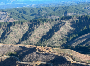
The recent rains caused slope failures within standing forest (e.g. above Bethany Park) as well as on cutover (recently harvested forest e.g. above the Riwaka-Sandy Bay Road), as well as erosion alongside streams and rivers, which resulted in a significant volume of other exotic and indigenous trees becoming involved in debris flows.
Every effort is being made to recover as much storm-damaged forest as possible, while the larger forest companies have been very quick to offer assistance clearing roads as well as properties neighbouring forest land from storm damage.
All forestry activity is constantly assessed for compliance with current regulations. Harvesting regulations require that no slash greater in diameter than 100mm and longer than 2m is left on land which is likely to be covered in water during a 5% annual exceedance probability event (also known as a 20-year storm).
We are committed to re-evaluating forestry rules. This will include integration of technical input from community and forestry industry workshops held in 2023.
We will also explore policy options that support greater stringency in high-risk areas, and look forward to further engagement as part of the Tasman Resource Management Plan review process.